Location of Claim
1809 vs. Modern Day
ELSIPOGTOG FIRST NATION

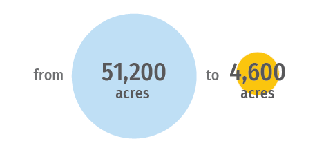
51,200 acres
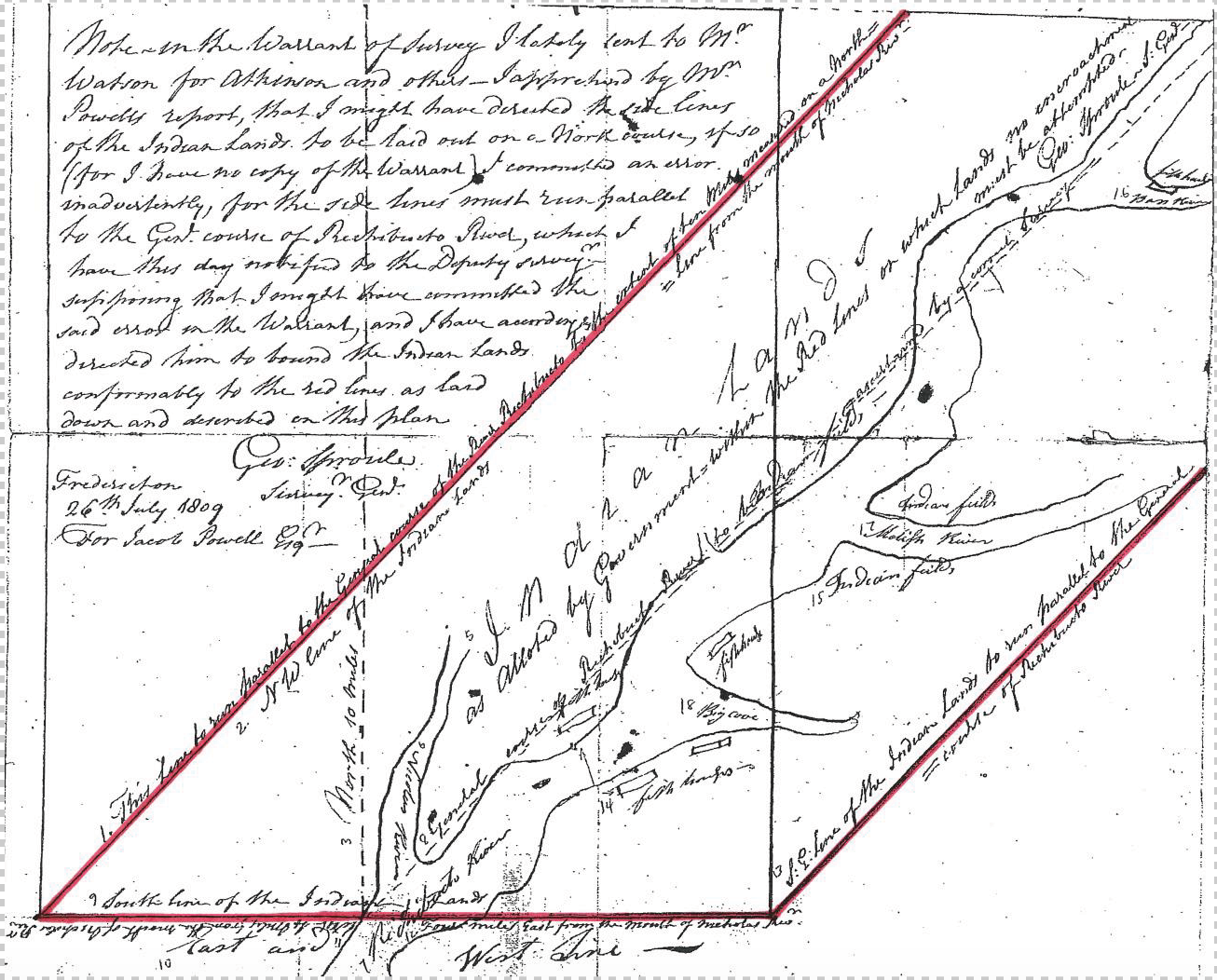
LOCATION OF THE RICHIBUCTO RIVER RESERVE, 1809

George Sproule, Surveyor General, [Plan of Richibucto Tribe Indian Reserve], July 26, 1809. N.B. Museum, Powell Family Manuscripts, Doc. File #4. BC-00018
4,600 acres
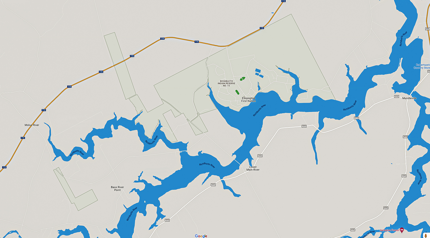
Modern Map
(Reserve outlined in green)

Negotiation Timeline
A legal team begins researching historical documents and draft a claim submission. Negotiations begin between Elsipogtog and a team of negotiators from Canada.
Contact Us
If you would like to see the data in person we are currently setup inside the Elsipogtog School, in Elsipogtog First Nation, New Brunswick. On location, we have historical timelines, negotiation process timelines, supporting historic letters and documents clearly outlined and open to the public.
Egt magemigmino | Our Land
Claims Center
Room 199, at the Elsipogtog “Old School”
356 Big Cove Road Elsipogtog, NB E4W 2S6
Have a Question?
We're happy to answer any questions you may have.
